


Lac du Puy Vachier

geranimo
User
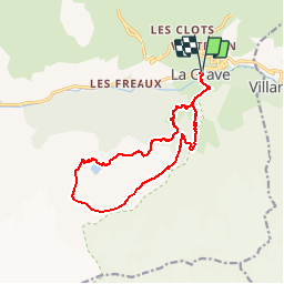

Length
14.4 km

Max alt
2844 m

Uphill gradient
1493 m
Km-Effort
34 km

Min alt
1443 m

Downhill gradient
1495 m
Boucle
Yes
Creation date :
2019-11-11 11:09:32.566
Updated on :
2019-11-11 11:10:55.723
--
Difficulty : Difficult

FREE GPS app for hiking
 SityTrail
IGN / Geographical institutes
SityTrail Plus
The world is yours!
About
Trail On foot of 14.4 km to be discovered at Provence-Alpes-Côte d'Azur, Hautes-Alpes, La Grave. This trail is proposed by geranimo.
Positioning
Country:
France
Region :
Provence-Alpes-Côte d'Azur
Department/Province :
Hautes-Alpes
Municipality :
La Grave
Location:
Unknown
Start:(Dec)
Start:(UTM)
287938 ; 4991564 (32T) N.
Comments